

IO Change Detection
Understand the risks, opportunities, and patterns in our rapidly changing world
Focused
Know where to focus attention and resources.
Timely
Save time analyzing imagery over large areas.
Efficient
Capture events from the most recent satellite imagery.
Customized
Monitor changes that matter to you.
Automated change monitoring for your workflow
IO's change detection uses satellite imagery to identify changes to land for a variety of applications.
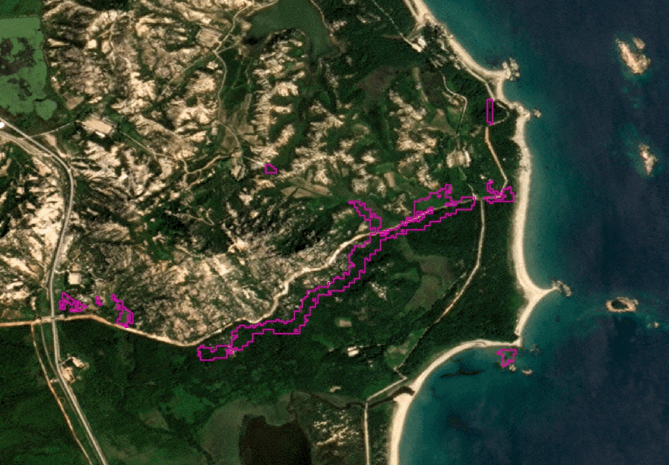 Changes to roads and coastline detected along the Korean Demilitarized Zone between 2022 and 2024. © Copyright 2022, 2024, Planet Labs PBC• All Rights Reserved
Infrastructure Monitoring
Detect and monitor progress of infrastructure, roads, and buildings.
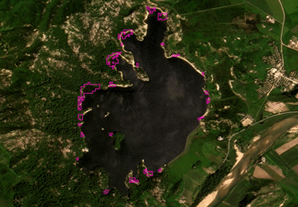 Lake water level changes detected in North Korea between 2022 and 2024. © Copyright 2022, 2024, Planet Labs PBC• All Rights Reserved
Environmental Insights
Monitor for changing water levels, deforestation, land conversion, and changing wetlands and coastlines.
Our Change Detection
Specifications that help you meet your goals.
| File Type | Raster or vector geospatial files |
| Available dates | 2017 to the present day |
| Projection | EPSG:3857 - WGS 84 |
| Spatial Extent | User selected AOI, minimum order size of 100km2 |
| Temporal Extent | Annual change, Bi-annual change, Quarterly change |
| Resolution | 10 meters |

Discover your possibilities!
Monitor for changes that matter to you by contacting our team.